After two years of drought, following severe freezes of 2010, the desert is finally recovering. This week, Jodie and I hopped on the motorcycles and covered 550 miles over two days to capture the Texas Bluebonnet, Prickly Pear, Ocotillo, and myriad of wildflowers reaching peak bloom at the lower elevations near the Rio Grande River. Here are a few pictures reflecting on the changing of seasons, and also the recovery of the blooming wild after a dormant period of “sleeping.”
The Big Bend bluebonnet, Lupinus havardii, is a much taller and showier cousin of the more familiar bluebonnet that was designated as the Texas state flower in 1901, although all lupinus in Texas are now recognized as the official state flower. The Big Bend bluebonnet grows to a height of 3-4 feet. The tallest of these were over 3 feet in height:


In one spot we found a white mutation mixed in with the traditional brilliant blue groups:

On the way to the “ghost town” of Terlingua, TX, famous for the Wick Fowler International Chili Cookoff, we began seeing large groups of prickly pear cactus flashing their brilliant yellow/orange blossoms:


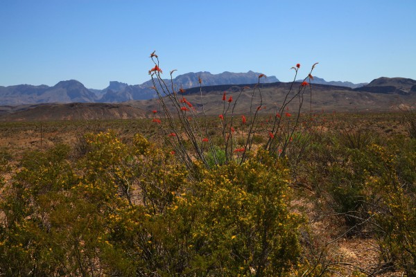
Also, the brilliant red seed pods of the ocotillo, not a cactus, but common to the Chihuahua desert of the Big Bend, wave like flags in the wind:

As we travel beyond the last parcel of civilization, and the last gas station, in Lajitas, TX, we follow the Rio Grande River, the international boundary between Texas and Mexico (assuming as most Texans do, that Texas is a nation unto itself), and stop for lunch along the river near a pool formed by the narrow constrictions in the river, and are treated to more bluebonnets:

This belies the actual volume of water flowing down this mighty river, because just around the corner it is obvious that our borders are separated in many places by a mere trickle of water. If you look closely at the narrowest constriction of the river in this photo, you will see that an adult can easily step across the Rio Grande here without getting feet wet. Here, the U.S. is on the left bank and Mexico is on the right. The flow on this day was only 24 cfs, whereas normal flow on this river used to be around 400-500 cfs, and sometimes approaches 20,000 cfs after periods of hard rain:

Bluebonnets abound everywhere, another group along the roadside, some of these nearly 4 feet tall:

Here, from a hill overlooking the Rio Grande, you see more bluebonnets in the foreground, with the Rio Grande separating Texas on the left and Mexico on the right bank:

From a similar vantage point, more prickly pear cactus “just showin’ off” along the border:

In most other parts of Texas, the wildflowers reach peak in early to mid April, but down here the growing season starts early, and early March to late March is the time to catch the desert in all its splendor.
Published by texasflashdude
Photography and Travel, specifically adventure travel and backpacking in remote North America, give me an excuse to stay outside. If kayaks, bikes, backpacks, Jeeps, archeology, geology and wildlife can be included, all the better. Having spent my life working in the fashion and photography industries, I love the unusual, the spectacular, and the beautiful. God has given us a wonderful world in which to live, and I try to open others’ eyes to its wonders. I have shared nearly 50 years of this indescribable wonder with my wife, Jodie, and we go everywhere together. I hope you will share some of our journey with us.
View more posts


It’s great that the Big Bend area is recovering after the horrible drought effects we saw last winter and spring, where even the cactus were dying and animal life seemed almost non-existent. Has the rumored opening of an automated border crossing station materialized yet?
Nothing yet. The station is ready to go, but more “studies” are being done, to what end I know not. Stay tuned.